Tuesday, February 21, 2023

Fish habitat job under SR 302 in Purdy Creek means full closure, temporary parking changes

By Angela Cochran

There may not be a pot of gold at the end of the rainbow, but the fish in Purdy Creek will think they hit the jackpot once our crews correct these culverts. The good news for the fish and human travelers is that work is finally kicking off on State Route 302/Purdy Drive very soon.

To recap, our project at Purdy Creek kicked off last fall on SR 16. At the time, crews were also scheduled to start work under SR 302/Purdy Drive. However, you know what they say about the best-laid plans – and that proved to be true. A combination of the weather and supply chain issues delayed the SR 302/Purdy Drive portion of the project. Our contractor now has the needed equipment in hand, and we are looking at work starting this spring.

Crews use heavy equipment and dump trucks to excavate the roadway on westbound SR 16 in preparation for building the new bridge

What this means for parking on Purdy Lane Northwest near Peninsula High School

First things first, crews must pave Purdy Lane Northwest to create the detour route for SR 302/Purdy Drive. This means a work zone will soon appear on Purdy Lane Northwest, near Peninsula High School. It also means shoulder parking will not be available on Purdy Lane Northwest for about eight months.

We understand that the shoulders on this county road are a popular spot for students to park while at the high school. For several months, however, travelers will need to use Purdy Lane Northwest as part of the detour. No parking will be allowed starting this spring through the end of the 2023 school year. The same parking restrictions will still be in place when school resumes in the fall and through early winter. We also understand that this, at the very least, is an inconvenience for people who park at this location. Please know we would not make these temporary changes unless they were necessary. Crews will work as efficiently and safely as possible to get the work done in order to reopen the parking.

Once crews finish paving the detour and activate the temporary signal at 144th Street and Purdy Lane Northwest, we will close the section of SR 302/Purdy Drive between the high school and 144th Street. The detour route, which will be used by motor vehicles as well as bicycles, will open. Keep in mind, Purdy Lane Northwest is a much narrower road than SR 302/Purdy Drive, even with the shoulder in use, so all users of the road will need to work together to give each other the space needed to safely travel the detour.

Customers heading to businesses located off SR 302/Purdy Drive will still have full access.

Once we close SR 302/Purdy Drive this spring, the detour will be via Purdy Lane Northwest and 144th Street Northwest.

Expect upcoming SR 302 around-the-clock closure and detour route

An around-the-clock total closure of the highway will be in place for up to eight months while crews remove the old culvert and replace it with a new bridge. You may wonder why these projects take so long. There is a small period of time during the summer that crews can actually work in the water without causing stress to the fish. Any delays on a project can bump work out an entire year.

Even with our delay for SR 302, we are still within the original anticipated timeframe of two years for the entire project.

So, when is all this happening? Paving and striping is weather-dependent work, so we need it to be dry. We are hopeful this work will begin sometime in March. We will update our project webpage with timelines as they become available. Real-time information is also available on our Travel Center Map.

Crews need to drill and excavate to lay the foundation for the bridge.

SR 16 construction reaches milestone

Meanwhile, the westbound portion of SR 16 is approaching its halfway point. Last fall, crews installed a temporary route around the work zone and shifted traffic into the median. Then they started the long work of building the bridge that is replacing the culvert. It kind of looks like they have been digging a big hole – and that is true.

Crews need to do a lot of drilling and excavating before they can start constructing the bridge. This allows them to lay the foundation. They have been doing that throughout the winter. Once crews finish working on the westbound side of SR 16, we will shift traffic onto the new bridge and move the eastbound traffic to a temporary route through the median. Then we will repeat the process on the eastbound side of the bridge. We expect that to happen sometime this fall. When both bridges are complete, travelers will be able to use the two new bridges for both directions of SR 16. That is when work will start underneath the bridges. Crews will excavate under the new spans to create a new and improved route for the creek. The overall effort will remove barriers to fish and open potential habitat.

Chum salmon spotted swimming in Purdy Creek near the SR 16 work zone

Slow down, pay attention, be kind

Travelers are likely going to see a lot of orange construction cones everywhere you go this year. As a reminder, please pay attention in work zones. Slow down and drive the posted speed. Stay calm, expect delays, and give yourself extra travel time. We want our workers to go home safely at the end of their shifts. Thank you for helping us make this a reality.
Friday, February 17, 2023

Northbound I-5 project in downtown Seattle reaches milestone

By Amy Moreno

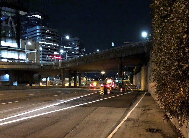
Drivers on northbound Interstate 5 near downtown Seattle might notice a return to an old driving layout. Crews closed the highway overnight on Wednesday, Feb. 15, to re-stripe back to the regular configuration between I-90 and Olive Way.

So why did drivers have to zig over a bit in the other pattern for the past few months? Crews started work in this area last year as part of a mobility project to add a third through lane and ramp meters to improve traffic flow. Construction dictated that traffic needed to shift so crews could install signs and wiring for the project.

Crews recently re-striped lanes on northbound I-5 in downtown Seattle, a milestone for this project that will improve travel through one of the state’s busiest areas.

This stretch of I-5 is a notorious chokepoint, even in the middle of the day on weekends. Creating more capacity to get vehicles through here is tough. I-5 is locked in through the heart of downtown Seattle with homes, businesses and city streets on both sides. We recognize that adding lanes doesn’t always solve traffic problems, so our team analyzes the “big picture” within our system, looking between the lines and outside for areas where it might make sense. Can traffic flow in a more efficient way? In this case, the answer is yes.

What seems like a conundrum turned into an opportunity for innovation for our engineers, who came through with this idea that works within our footprint and shifts barriers to create another through lane near Seneca Street. The plan includes meters to help traffic flow from I-90 and nearby ramps so mainline traffic doesn’t clog with that increased capacity.

This week’s re-striping is just the first milestone of many for this project. Coming attractions? Another lane through this stretch and ramp meters for the collector/distributor and at Cherry Street. Crews still need to finish electrical work, build sign bridges and install new traffic sensors and cameras. Finally, there will be one more reconfiguration and striping in late summer to make this improvement for mobility a reality.

If you don’t drive late at night through downtown, you might miss many of the lane reductions and construction involved in this project. These crews work hard, and this location, on the state’s busiest roadway, brings challenges to every aspect of this work. 

Crews prepare to hang new signs as part of the Seneca Mobility project

The work on this entire project should be completed later this summer, but this week, take a moment to enjoy the refreshed lines. When it comes to the road, the crews enjoy the satisfaction of those beautiful straight lines and the improved visibility that comes with them as much as drivers do. Behind the scenes, we’ll keep thinking “outside the lines” focusing on innovative ways to improve transportation.

Wednesday, February 15, 2023

Repairs coming to SR 410 near Crystal Mountain after November debris flow

By David Rasbach

Located just northeast of Mount Rainier, Dry Creek rarely is as barren as its name would suggest, but a rainy start to November left it anything but dry.

Unusually high rain totals during the first five days of November caused a debris flow that changed Dry Creek’s path under State Route 410, causing it to spill over the road. The good news is repairs are on the way.

SR 410 provides vital winter access to Crystal Mountain Resort and in the summer serves travelers heading to Mount Rainier National Park or over the Cascade crest on Cayuse and Chinook passes.

After considering a variety of options, we developed a two-part plan that will allow for repairs without full closures of the highway during peak ski season while protecting the highway during spring snow runoff. The first part of the repairs will involve single-lane closures with alternating traffic in late February, allowing us to hold off on a full closure of SR 410 until later in the spring or summer.

Debris flow

During the first five days of November, about five inches of rain was recorded at the Corral Pass weather station near Dry Creek. That’s five times the 10- and 20-year averages for those dates according to records collected by NOAA’s National Centers for Environmental Information.

On Nov. 4, alone, the Corral Pass station recorded a whopping 3½ inches of rain, soaking the area that Dry Creek drains. Part of Dry Creek’s watershed includes a large burn scar left by the 2017 Norse Peak Fire, which burned tens of thousands of acres.

Up to two feet of debris covered SR 410 near Crystal Mountain Resort after a Nov. 5, 2022 debris flow caused Dry Creek to change channels and plug
a small culvert under the highway.

There was simply too much water for the saturated ground in the area to retain, and early Nov. 5, a debris flow of mud, trees, rocks and sediment broke loose and rushed down Dry Creek.

There are two historical channels that cross SR 410 about two miles before the turnoff to the Crystal Mountain Ski Resort and 12 miles up the hill from Greenwater, and Dry Creek traditionally flowed through the south channel.

As the debris flow gained momentum through the Dry Creek channel, massive trees and rocks plugged the creek’s path about 600 feet above SR 410, forcing the debris flow to find a new route as it rushed downhill. With the south channel literally filled to the brim, Dry Creek jumped into its older, unused north channel and roared toward SR 410.

A huge rain storm this past November overwhelmed culverts and the hillside, leading to debris covering SR 410 near Crystal Mountain Resort.

The flow overwhelmed and plugged a small culvert placed at the crossing of the north channel, causing water and up to 2 feet of debris to spill across the road and forcing us to close the highway for several hours. Emergency crews and highway engineers inspected and cleared the road leaving Dry Creek to flow through a 24-inch culvert instead of the 4-foot culvert a few hundred feet up the highway along its previous path.

Dry Creek’s new path

Though sediment and water did scour the embankment on the west side of the highway, our inspectors found SR 410 fared rather well. Maintenance crews built the embankment back up and stabilized and cleared the road, allowing it to reopen.

While operations along SR 410 essentially returned to normal, the same cannot be said for Dry Creek. A debris dam of trees and boulders – more than 50 feet high in some places – still prevents the creek from flowing through its previous path to the White River below.

“All of Dry Creek is now running to that smaller culvert,” Project Engineer Cullen Anderson said. “These colder months, I think we’ll see some stability there because everything is locked up in snow and ice.

“But as soon as we get to the spring melt, which based on nearby gauges looks like it occurs in March and gets really ramped up in April, you’re going to see all that snowmelt being conveyed to that culvert, and it’s very, very likely that we could have a similar if not more extreme event, where once that culvert gets plugged, all that runoff will back up and start coming over the roadway.”

SR 410 near Crystal Mountain closed this past November after a large rain storm caused debris to cover the highway.

That could trigger more serious problems, including more scouring of the embankment and damage or loss of the road, which is the only way in and out of Crystal Mountain Ski Resort when Cayuse and Chinook passes close for the winter.

Removing the debris dam to allow Dry Creek to return to its previous channel is not an option, as it would take large excavators and other heavy machinery cutting a path through several hundred feet of thick forest to reach the dam and clear the now-fully-filled former stream bed. Additionally, the dam is located well outside our right of way on U.S. National Forest land.

“That leaves us with the option of trying to increase the capacity of the culvert in order to be able to convey the flow heading to it,” Anderson said. “That’s what we’re working on right now is designing a culvert that can go in quickly that will convey all the runoff through this area.”

That means excavating a 100-foot stretch of the highway, installing a 10-foot culvert and rebuilding the road. It is expected that work will require a three-day full closure of the road. Once that work is done and SR 410 reopens, crews will regrade Dry Creek’s channel and rebuild and armor the embankment.

A debris flow this past November along Dry Creek overwhelmed a 24-inch culvert under SR 410 near Crystal Mountain Resort, causing water and about two feet of debris to cover the highway. It also caused scouring along the shoulder and embankment.

Finding a solution

With the spring thaw just around the corner, our engineers have considered several concepts to make the needed repairs, fully aware that skiers, winter sports enthusiasts, local businesses and residents depend on that section of SR 410 during the winter.

After examining different options of how to reduce the effect of a full road closure, we decided to break the emergency project into two parts.

A debris dam of rocks, trees and sediment about 50 feet high plugged Dry Creek’s channel after a November 2022 rainstorm. It permanently changed
the path of the creek under SR 410.

The first will need to be done in late February and involves inserting three 24-inch overflow culverts a few feet beneath SR 410 to divert any excess runoff beyond what the existing culvert is capable of handling. Work on this portion of the project should be mostly completed while closing only one lane at a time, allowing alternating traffic to pass.

The hope is that the additional culverts will provide a safety measure to prevent an incident similar to what occurred last fall. That should allow the second portion of the project – the part that will require three days of full closure of SR 410 to insert a larger, more permanent culvert deeper under the highway – to proceed after peak ski season later this spring or summer.

Though Mother Nature controls when the highest spring runoff will be, we plan to complete the project before traffic along SR 410 picks back up with the opening of Chinook Pass, which typically occurs in late May.

Looking at alternatives for I-5 through the Nisqually River Delta

By Mark Krulish

It’s the traditional home of the Nisqually Indian Tribe. Visitors to the ecologically diverse Billy Frank Jr. National Wildlife Refuge know the area is home to bald eagles, waterfowl and a pit stop for migrating birds. The river at this location divides Thurston and Pierce counties. Within this setting sits Interstate 5 – the main mover of people and goods along the west coast, from Mexico to Canada.

How will this I-5 corridor look and feel in the future? That’s what we are studying right now. …and we need your input.

We are tasked with making the best decisions for the future of this critical connection. Every step of the way, we need you to help us make those decisions.

Now through March 1, we have several design options that we want your feedback on.

Studying the alternatives

Lately we have been busy looking at different alternatives to improve this roadway. As part of this process, we have been collaborating with local governments, local tribes, transit agencies, JBLM and the Federal Highway Administration.

A look at one of the design options for the Nisqually Valley project, including a new elevated I-5 interchange

In our February round of advisory meetings, we will look at these design options to get feedback from these representatives.

But we also need input from the public. This is where we need your help.

Submit your feedback

Through the end of February, our engage web page will host a few different design options under consideration.

A look at another design option for the Nisqually Valley project

We have simple improvements to reduce demand for single-occupancy vehicles. This would rely on coordination with local governments and entities to work in tandem with us to implement their own strategies for things such as express bus service and providing support for alternative travel modes – such as walking and biking. This option could also include environmental improvements for the Nisqually River channel by replacing the existing bridges with new structures.

We also have designs to widen I-5 in the area by adding general purpose or HOV lanes, converting general purpose lanes to HOV, or building a long, elevated bridge up over the Nisqually River Delta area.

Take a look at the designs on our engage web page. Once you have reviewed them, there will be a place to leave your feedback. This is the best way to ensure your comments are incorporated into final report.

Keep up with the latest news on our project page, where we post materials and videos of our meetings with local agencies. You can also sign up for email updates here. Simply click on the link and enter your email address.

Tuesday, February 14, 2023

Time to let off the gas as construction speeds up on I-5 in Fife

By Lizzy Buechel

While driving through Fife on Interstate 5 last summer and fall, you might have noticed that lanes were narrowed and shifted toward the middle of the road in both directions. You may have also seen signs informing travelers about potential slowdowns ahead of these shifts. Well, another round of lane shifts in that area is coming, along with a new temporary 50 mph speed limit.

Variable message signs alert drivers on I-5 to potential slowdowns
near SR 167 Completion Project work zones.

Shifting lanes means construction is progressing

Construction crews working on our SR 167 Completion Project are widening I-5 to create room for a work zone in the median area of the interstate. This work zone will help support construction of new bridges on I-5 that will cross the project’s relocated Hylebos Creek as part of the Hylebos Riparian Restoration Program. The restoration program will improve the flow of the creek and reduce flooding on I-5 as part of the Puget Sound Gateway program.

Last summer, traffic shifted toward the median of I-5, allowing crews to begin work in the shoulders to build outer lane extensions for travelers. Soon, traffic will shift to the newly constructed outer lanes so construction crews can begin working in the median.

SR 167 Completion Project work zone along I-5 allows crews to start widening the road
in both directions to prepare for a traffic shift to outer lanes.

Speed reductions on northbound and southbound I-5 in Fife

Traffic shifts, reduced lane and shoulder widths, and reduced sight distance at the Fife curve around these construction work zones require a speed reduction to ensure work zone safety and enhance driver awareness of the construction sites. On Wednesday, Feb. 15, a 50 mph speed limit was put in place on northbound I-5 between milepost 137.5 (near 54th Avenue East) and milepost 139 (near Porter Way). The southbound speed reduction on the same stretch of road will happen as early as Tuesday, Feb. 28 or potentially Wednesday, March 1, depending on the weather. The speed reduction will be in place through the summer.

Drivers can expect traffic lanes on I-5 to shift away from the median through winter 2024 while crews build the new Hylebos Creek bridges.

Completing State Route 167

This construction work is part of our SR 167 Completion Project which will build six new miles of tolled highway between Puyallup and the Port of Tacoma to improve the movement of freight and reduce congestion on local roads and highways in the surrounding area.

The first stage of the project, stage 1a, was completed in summer 2022, and built a new four-lane bridge over I-5 in Fife, a new multi-lane roundabout connecting the new Wapato Way East bridge to SR 99, and constructed improvements to the Interurban Trail.

The work on I-5 in Fife is part of stage 1b of the SR 167 Completion Project. This stage will be complete in 2026 and the entire SR 167 Completion Project will be finished in 2028.

For more information

Visit the project website to learn more or call our hotline at 253-220-5009. Interested in a presentation to your civic group? Please reach out to schedule a briefing via email at SR167CompletionProject@wsdot.wa.gov.

Thursday, February 9, 2023

Work on I-5 in Everett getting closer to complete

By Kurt Batdorf

We. Are. Getting. Close.

Starting Monday, Feb. 13, our contractor rolls out the diamond-tipped grinders to start smoothing over the two northbound right lanes of Interstate 5 in Everett during 11 nights of work over the next three weeks.

This means just one lane of northbound I-5 will be open between 8 p.m. to 6 a.m. from Feb. 13-16, Feb. 21-23 and Feb. 26-March 2. We hear the collective groan of drivers, and we get it.

But it also means we’re getting closer to a milestone on this rehabilitation project. By March 2, the two right northbound lanes will be nice and smooth between Lowell Road and the Snohomish River Bridge. If things go well, we have a plan to smooth over the left lanes, too. If we can’t get to the left lanes this time, we’ll need to schedule that work at a later date.

A contractor works on 10 concrete panels that were replaced in 2022 on I-5 in Everett. Crews will grind all the new panels in the right two lanes between Lowell Road and the Snohomish River Bridge starting Feb. 13.

The past few weeks have been disruptive, we know. We had to do an emergency weekday pavement repair that really messed up the day’s traffic.

And then, seeing that we might have more emergency repairs if we waited a couple of months to finish this phase of the project, we were able to finish replacing the last of 200 concrete panels over a weekend, though again, it meant multiple lane closures for a couple days in a row, and we know that can be frustrating.

Why is it still bumpy?

We heard from some drivers that the new concrete panels are rough. “Almost like hitting a speed bump,” someone said.

There’s good reason the new concrete felt like you hit a bump. It sits a little higher than the existing 1960s-era concrete so that when the contractor grinds the pavement smooth, all the panels end up even.

The new concrete panel (nearest to us) sits a little higher than the surrounding concrete that was poured in the 1960s. Our contractor will use diamond-tipped grinders to smooth out the two right lanes of I-5 in Everett to create a smoother surface.

Think of it this way. If you’re cutting a piece of lumber to a specific height, you often cut it a little long, because you can always trim it down. If you cut it too short, you just made a piece of scrap.

It’s the same principle with concrete pavement. We can’t make the new concrete panels higher (or deeper or thicker) after the wet cement sets, and we don’t want to grind off more of the existing concrete than necessary at the risk of turning those panels into scrap. That’s why you had to feel a bit of a bump. There wasn’t enough time during the weekend work to replace the panels and grind them down smooth before we had to reopen to traffic by Monday morning.

“Measure twice, cut once,” as carpenters say.

The 11 overnight lane closures won’t be a picnic, but we think you’ll appreciate the results. No more ruts in the old concrete. No more bumps in the new concrete.

The final milestone on this project is replacement of four I-5 bridge expansion joints north of 41st Street, at Pacific and Hewitt avenues, and at US 2. Our contractor will start on that phase in a few weeks. Yes, we’ll have more lane closures but we expect to have two lanes open so traffic will flow a little better. We’ll tell you about it with a blog post and other social media posts when we get closer to the start date.

Wednesday, February 1, 2023

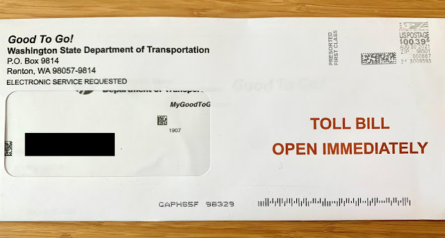
Grace period for suspension of late fees, civil penalties for unpaid tolls ends March 1

Tips on how to avoid a higher bill

By Chris Foster

Starting March 1, 2023, we will begin charging late fees and penalties for unpaid toll bills. We want to help customers resolve unpaid bills and lower their existing bill before that date gets here, though. Our goal is to help customers avoid fees and penalties by getting their toll paid.

This blog provides tips on how to avoid a higher bill and what customers can expect after March 1.

Pay By Mail customers with unpaid tolls dating back to June 2021 will soon be charged late fees

We stopped charging late fees and civil penalties in June 2021, which means some unpaid tolls more than a year old could soon be charged a $5 fee or $40 civil penalty. The most important thing to note is even if the trip in the toll lane happened several months ago, these tolls are accurate and valid.

If you have unpaid tolls, the timeline for when you will receive a $5 late fee and/or a $40 civil penalty depends on the due date for the unpaid toll:

  • If you have an unpaid toll and the due date listed on your bill is before March 1, you will be charged a $5 late fee if the bill remains unpaid.
  • If you have an unpaid toll that was already charged a $5 late fee, your tolls will soon be assessed a $40 civil penalty for each unpaid toll.

Please note we mail bills to whoever is registered as the vehicle’s owner with the Department of Licensing (DOL). If you drove on a toll road and never received a bill, make sure the address on your vehicle’s registration is up to date.

If you’ve been waiting to pay your toll bill, now’s the time! Late fees return March 1.

Tips for Pay By Mail customers to avoid paying more

After more than a year of not charging late fees and civil penalties, we know that there’s a greater potential for some higher toll bills if people have been traveling frequently on tolled roads and not paying their bills. However, it’s not too late to save on unpaid bills:

  • Lower your unpaid bill at no cost: We strongly advise you to make a payment as soon as possible. You can save $1.75 for each unpaid toll by opening a Good To Go! account at no cost. To open an account and save money on your tolls, enter your toll bill/statement information on this page (https://mygoodtogo.com/EN/bill-payments/toll-bills/landing) and click “Go”.
  • Waive fees or penalties: While we do have a one-time penalty forgiveness program, which you can use to waive fees and penalties if you pay the original tolls, it’s best to resolve any unpaid tolls as soon as possible to avoid further fees and penalties.
  • Can’t find your toll bill? If you think you may have unpaid tolls but never received a bill, please contact the Good To Go! customer service center. You’ll need to provide the name and address on your vehicle’s registration, along with the vehicle’s license plate number.

Good To Go! accounts with unpaid tolls

The new system includes some changes for those with a Good To Go! account that has a negative balance and unpaid tolls. If you have a Good To Go! account, log in to your account to make sure everything looks OK and that your account is up to date with your current email address, mailing address, vehicle(s) and pass(es). We send out monthly notifications to account holders with unpaid tolls and suggest you check your account on a regular basis.

Unpaid tolls reapplied with $2 higher rate

If tolls charged to your account remain unpaid for 30 days, you’ll see those unpaid tolls credited back to your account, followed by a new transaction where the toll is reapplied at the higher Pay By Mail rate ($2 more per toll). We will also send you a bill in the mail.

An example of how tolls will be displayed on your Good to Go! account dashboard
if your balance remains negative

After March 1 you have until your next statement date to make a payment before your unpaid tolls are re-applied to your account at the higher Pay By Mail toll rate and you’re charged a $5 late fee (you can find your statement date online by logging in to your account and navigating to the “Statements & Activity” menu). That said, it’s best to take care of any unpaid tolls now to avoid paying an extra $2 for each unpaid toll and a $5 late fee per bill.

Please be patient

Once we begin charging late fees and civil penalties, we know it will be busy at the call center. Thankfully, our new system offers several ways to manage your account online without needing to talk to us.

If you do need to speak to a customer service representative, please be patient. We’re expecting high call volumes which will mean long wait times.