Wednesday, July 31, 2024

SR 165 Carbon River Bridge highlights preservation challenges in our state

Update: 5 p.m. Tuesday, April 22, 2025

On Tuesday, April 22, 2025, the Washington State Department of Transportation announced the permanent closure the 103-year-old State Route 165 Carbon River Fairfax Bridge.


Update: 3:30 p.m. Monday, April 14, 2025

On Monday, April 14, 2025, the Washington State Department of Transportation closed the State Route 165 Carbon River Fairfax Bridge to all vehicle and pedestrian traffic until further notice.


By Cara Mitchell

View from underneath a bridge stretching over a wooded canyon. The bridge is made of wood and steel. Some of the supporting steel beams below the bridge have rust on them.
The Carbon River Bridge on State Route 165 is also called the Fairfax Bridge.

It's a sign of the times. On Friday, July 26, our state bridge engineers had to further limit the types of vehicles that can use the 103-year-old Carbon River/Fairfax Bridge in Pierce County.

The new weight limit is 8 tons, or 16,000 pounds. Anything over that weight limit can no longer cross the bridge. This is the third restriction we've had to place on the bridge since 2009. In 2013, commercial vehicles were restricted crossing the bridge.

We know the latest restriction is especially tough for people who live south of the bridge. There is no detour available. We are working with private property owners and signed an emergency declaration with the hopes we can create an emergency detour access route for locals and first responders.

What changed on the bridge

The 494-foot-long bridge has been inspected every two years by state bridge engineers. This spring, engineers rappelled down the side of the bridge to measure the condition of the bridge's steel components. They used this data to calculate the revised load rating.

Left: A closeup view of a bridge steel beam with weathered paint. The steel is rusted where the paint has chipped off. Right: A closeup view of a bridge steel beam with severely weathered paint. The steel is rusted and degrading where the paint has chipped off.
Photos from 2022 and 2024 show the advancing deterioration of steel sections of the bridge.

The center portion of the bridge is built out of steel, while the bridge approaches are timber. Steel deteriorates over time as it's exposed to rain or snow. Water on steel over time forms rust, which weakens the steel. We combat rust on bridges by painting them. The last time the bridge was painted was in 1988. Since then, we have repeatedly recommended this bridge as a candidate for replacement due to its overall condition and age. In 2023, it was removed as a candidate for replacement due to funding constraints.

As of June 2023, 55 steel bridges were due for painting, 47 were past due and six were being painted. Decades of underfunding maintenance and preservation has resulted in a backlog of work needed keep our transportation system in full operation. We do our best with the funding we are given by the Legislature. We continue to work with state leaders to communicate our needs and the risks associated with those needs being unmet.

Will the bridge be replaced

Deferred preservation has been an ongoing issue for years. Prior budgets passed by the Legislature have not provided funding to replace or make repairs to the bridge, and the SR 165 Carbon River/Fairfax Bridge is now a tangible example of a much larger issue in our state. Without more investment in preservation, we will continue to see more bridges weight listed, longer detours (where applicable) in place and highways with "rough road ahead" signs.

The bridge is competing with other aging bridges across the state. As of June 2023, 315 of our 3,384 bridges were 80 years old or older, accounting for 9.3% of all state-owned bridges. Factors such as traffic volumes play into which bridge rises to the top of the list for replacement.

Our bridge maintenance teams have done their best to keep the bridge in good working order. As an example, we replaced sections of a failing wooden bridge deck last May.

Left: View from the top of a wooden bridge deck during repairs. Pieces of old wood are missing from the bridge deck. Right: A bridge maintenance worker in an orange vest and white hard had installing new wooden panels on a bridge deck.
Olympic Region bridge maintenance crew members replacing aging wood bridge deck panels
on the bridge on May 16, 2024

Because of the new load rating, our crews will increase the frequency of inspections on the bridge to every six to 12 months.

We know there are some who will say, "the Brooklyn Bridge is even older and it's still open." This is true. Hundreds of millions of dollars have been spent to keep that historic bridge in good working order. That hasn't happened in Washington state.

Typically, a bridge has a service life of 75 years, based on current standards. In Washington, the average age of state-owned vehicle bridges is 51 years. At age 103, our Carbon River Bridge has held up well. That's in large part because of dedicated bridge engineers who routinely inspect the bridge and bridge maintenance crews who make repairs. The bridge was built in 1921 for $500,000. According to History Link, it was the tallest bridge at the time in the state. Over 100 years later, there are very few highway construction projects, let alone a bridge, that cost $500,000. For instance, we just opened a new bridge in Clallam County that replaced another almost 100-year-old bridge to the tune of $42 million.

New signs and changes to intersections: What travelers need to know

New weight limit signs for the bridge are on order and we are moving quickly to install them.

The bridge is in a rural area with little room to turn around so we're putting advanced warning signs on roads leading to it. You'll soon see signs on SR 165 leading up to the bridge from SR 162, Wilkeson and Carbonado. Those signs are meant to catch the attention of anyone who is driving anything over 8 tons before they get to the bridge.

We're also making some changes to the intersection of SR 165 and Pershing Avenue in Carbonado. The intersection will become an all-way stop. The same goes for the intersection of SR 165 (Mowich Lake Road) and Carbon River Road. The all-way stops will allow drivers another chance to stop, change direction, and make informed decisions prior to crossing the weight-restricted bridge.

What vehicle weighs 8 tons?

Knowing how much your vehicle or the load you're pulling weighs is always important.

  • 1 US ton equals 2,000 lbs.
  • 8 US tons equals 16,000 lbs.

The bridge is closed to any vehicles that exceeds the maximum weight limit of 16,000 lbs. (8 tons). Official vehicle weights might be found in your vehicle's manual or inside the driver's side front door. Some vehicle registrations will also include this information. There are also fee-based weigh stations that you can use to weigh your vehicle.

A quick Google search shows us that a 2024 Subaru Forester weighs around 3,528 pounds, empty. A Ford F-150 has a curb weight up to 7,000 pounds. Full size RVs can range from 10,000 pounds to 30,000 pounds depending on make and model. Your mid-size SUV will likely be ok to cross the bridge, but better check the weight of the pickup or RV you're driving or pulling before you go. Keep in mind, drivers must add the weight of fluids, loads and people traveling in the vehicle to determine if the vehicle is over the gross weight restriction.

Stay informed

We will share more information with our community partners and property owners in the coming weeks. People can sign up to receive updates on the SR 165 Carbon River Bridge through GovDelivery.

Information line about the bridge is available at: (360) 704-3268

For real-time travel information, visit wsdot.wa.gov and search WSDOT Travel Map and WSDOT Mobile App.

Thursday, June 13, 2024

Galloping Gertie’s replacement is a Boomer, and it needs work

By Cara Mitchell

You’ve likely seen the memes about Boomers, Gen X, Millennials and Gen Z.

We have a new one for you, and it involves two bridges across the Tacoma Narrows:

Photo of Tacoma Narrows Bridge with Gen Z vs Boomer text overlay

Our 1950 westbound bridge, from Tacoma to Gig Harbor, is a Boomer.

The 2007 eastbound bridge, from Gig Harbor to Tacoma, is a Gen Z.

One is 74 years old while the other is still virtually a teenager.

In recent years, we’ve seen issues with our aging westbound bridge. The most recent episode was in mid-May when an expansion joint required us to reduce the bridge from four to two lanes for several days.

In late May, we discovered more issues on the same bridge involving a type of expansion joint called a finger joint. It is called this because it resembles a finger on a hand. These joints allow the bridge to expand and contract. The parts to fix it took a few weeks to be custom manufactured. You can’t order these parts off Amazon.

Photo of a cracked finger joint on the westbound Tacoma Narrows Bridge
Photo shows a cracked finger joint on the westbound Tacoma Narrows Bridge.
The finger joint will be repaired June 15-16, 2024.

The repairs this time mean the westbound SR 16 Tacoma Narrows Bridge will be reduced from four lanes to two from 4 a.m. Saturday, June 15, to 4 p.m. Sunday, June 16.

Image of Robert Downey Jr. as Tony Stark rolling his eyes
Real-time reaction from travelers reading that there’s more repairs on the way

Fortunately, this work could be scheduled over a weekend when there is less overall traffic. That won’t always be the case. Based on the age of the bridge, we know more emergency closures are in our future.

Years of underfunding both our highway Operations & Maintenance and Preservation programs have put our transportation system in jeopardy. Our highway maintenance crews provide short-term repairs like filling a pothole. Longer-term preservation work like roadway surfacing or bridge deck rehabilitation extends the life of our infrastructure. Both programs are needed to work in concert with one another. Unfortunately, given the number and age of our bridges, there is just not enough dedicated funding to keep them from developing age-related problems.

Tacoma Narrows Bridge crew members working under the bridge deck, fabricating forms
to pour new concrete during the emergency lane closures in May.

Lengthy repair list keeps growing

The westbound Tacoma Narrows bridge is one of the largest in our state bridge inventory. Given its age and how heavily it is traveled (45,000 vehicles each day, on average), it has a long list of repair needs including:

  • Replacement of expansion joints
  • Mechanical repairs of the elevators in the towers
  • Emergency electrical system supply upgrades
  • Rehabilitation of the superstructure damping mechanisms at the towers
  • Various structural repair needs throughout the bridge, such as tightening nuts, addressing rust and corrosion, replacing damaged rivets and bolts and replacing damaged structural members.
  • Fully removing and replacing the paint at the towers, trusses, cables and suspenders.

We have a preservation project designed to fix expansion joints on the westbound bridge that will extend the useful life of the bridge. The not-so-good news is that the project is delayed because we don’t have the funds to do the work. The earliest this project can now occur is 2026.

About those tolls

Before you type in all caps “whatabout those tolls,” a reminder that tolls don’t pay for maintenance on the westbound Tacoma Narrows Bridge. Tolling on the eastbound SR 16 Tacoma Narrows Bridge helps repay the costs to build the eastbound bridge, which opened in 2007. Tolls are only collected for trips headed to Tacoma, and toll rates are a fixed rate no matter when you travel. The Washington State Transportation Commission adopts state highway tolls.

Years of underfunding Operations & Maintenance and Preservation is catching up

Not having the funding we need means hard choices are made. Legally, we can’t overspend our budget. That means the agency must decide and prioritize which maintenance activities and preservation projects need to be delayed to stay within the budget we have. This is just like the tough choices people make with their personal budgets.

This is happening with the 1950 Tacoma Narrows Bridge and hundreds of other bridges and highways across the state. As of June 2023, 315 of our 3,384 bridges were 80 years old or older, accounting for 9.3% of all state-owned bridges. The number of WSDOT-owned bridges in poor condition increased 7% from 199 bridges in June 2022 to 213 in June 2023.

Washingtonians own a multimodal state transportation system that would cost nearly $200 billion to replace, but we’re not spending what we need to keep that system in good working order. This isn’t new information, and something our Secretary of Transportation and other agency executives have shared regularly with elected officials, local governments and other partners over the last eight years.

Both the Operations & Maintenance and Preservation programs aren’t about adding new things. Rather, they each play a role in taking care of what we already have.

For example, funding in the Operations & Maintenance program supports repairing potholes repairs, patching bridge deck patches and recent emergency closures on the westbound Tacoma Narrows Bridge. Planned preservation work, such as resurfacing a roadway or rehabilitating all the bridge joints in one project, are needed investments to keep the transportation system running smoothly.

Think of it like taking care of the roof on your house. Getting grime out the gutters and annual cleaning, that’s maintenance. Putting new shingles on, that’s preservation. You can clean a roof with old shingles and replace the shingle that is in bad shape. But, if you don’t put new shingles on your roof, eventually it will deteriorate over time and cost even more to fix down the road.

Maintenance crews holding things together

Photo of a Tacoma Narrows Bridge crew performing inspections high on the bridge
Tacoma Narrows Bridge crews perform inspections and
maintenance every week on both bridges

Our dedicated maintenance crew performs weekly detailed inspections and maintenance for both bridges. They identify, troubleshoot and address the many items needed to keep travelers moving. Their work is essential to the safe operations and extended service life of these bridges.

A separate team, our Bridge Preservation Office, also performs various engineering inspections (routine, in-depth, underwater, mechanical, electrical, structural) at set 1-year, 2-year, and 5-year intervals.

The point: we aren’t neglecting the bridge. It’s aging, and temporary fixes only go so far.  The team that cares for this bridge takes a lot of pride in their work. They strive to keep this span in the best condition they can. And it’s important to share this information so travelers understand what we are all facing.

More lane closures and extended drive times

There is never a good time to close lanes on the westbound bridge for emergency repairs. We know the weekday evening commute becomes brutal when this happens.

It wasn’t that long ago when there was only one bridge, and travelers had to plan an extra hour to cross the Tacoma Narrows during rush hour.

 So, why can’t we just move traffic to the other bridge during rush hour like Seattle’s Express Lanes?

While this seems straight forward, it isn’t as easy as it sounds.

Switching directions of travel across the State Route 16 Tacoma Narrows Bridge is possible. We designed it to work that way. But it works best for long term events. We did it in 2016 when the bridge decks were re-paved.

Putting this into place requires miles of traffic control barrels, reflective tape, cones and signs on both sides of the bridge. It requires reduced speeds in both directions and hours of set up. When you remove it, the entire process has to be repeated.  A switch like that when we’re closing lanes for emergency work would likely result in more backups – not less – for travelers.

Travel tips

When you hear another emergency repair is underway, have a plan in place. Alter flexible, non-essential trips. Telework if you can. Travel during non-peak commute hours if possible. Please know we’re doing the best we can in a tough situation and we appreciate your patience and any steps you can take to help lessen the congestion.

Real time travel information is available on the WSDOT app and the statewide travel map.

To take a deeper dive into our bridge performance measures, check out detailed bridge information found in our Gray Notebook.

Thursday, December 28, 2023

Protecting US 2: Project reduces debris flow risk to highway near Bolt Creek Fire burn scar

By David Rasbach

The 2022 Bolt Creek Fire burned nearly 15,000 acres in the Mount Baker-Snoqualmie National Forest. We had to close US 2 east of Gold Bar several times because of the active fire and debris falling onto the highway. The fire also left a burn scar that will take several years to recover.

Even after the fire, there is still a chance that debris, such as rocks and mud, might flow down from the Bolt Creek Fire burn scar. But we have good news! We just finished a project that will make it less likely for debris flows to block travel along US 2/Stevens Pass Highway.

Burn scars and debris flows

Wildfires can change the landscape, turning dense trees and vegetation into large areas with ashes and dry soil, known as burn scars.

If it rains a lot or snow on the ground melts really fast, these burn scars can produce fast-moving landslides called debris flows. These can be dangerous and might harm people and property within their path.

After the Bolt Creek wildfire, our geotechs studied the area and found two areas near the burn scar, about four miles northwest of Skykomish, where there is a higher risk of debris flows that could affect US 2.

Protecting the road: culverts and berms

In one of these areas, there are two culverts under US 2 that might get clogged if debris flows down the stream.

If the culverts clog, water, rocks and even trees could spill across the highway, forcing us to close it to clean up and maybe fix the guardrails and pavement.

To reduce this risk, we built two debris fences – one 60 feet long and the other 110 feet long – above each culvert. These fences should help stop some of the debris that reaches the culverts if a debris flow happens.

A stream channel above US 2 about 4 miles northwest of Skykomish. The channel is filled with rocks, and vegetation grows nearby. A long compost sock sits near the channel to control erosion.
Debris fences were installed along the stream channels above two culverts under US 2 to help
reduce the chances a debris flow could clog the culvert.

concrete being poured into a square wooden frame in the ground. A circular rebar foundation is in the center of the square.
Crews pour a post foundation for a new debris fence along US 2.

A large, blue and yellow drill balanced on a hill side drills an anchor hole for a debris fence being installed along US 2 near Skykomish. A crew member sits above the drill.
Work crews drill holes where anchors for posts that will support a debris fence
along US 2 will be installed.

a worker stringing up a debris fence between two metal posts in the ground. Two circles are suspended on wires, and an orange plastic fence is in the background.
Crews begin hanging a new debris fence along US 2 near Skykomish.

Work crews placing a tan erosion blanket over the earth berm along US 2. A dump truck towing a trailer with construction equipment sits along the shoulder of the highway.
The project installed two debris fences above culverts that run under US 2.

A few hundred feet up the highway, our geotechs identified a second area where a debris flow could slide across US 2.

In this area, our experts thought it would be a good idea to build a 6-foot-tall wall, called a berm, made of natural materials. This berm will guide any potential debris flows away from US 2 to a lower natural “catch” area near the highway. The berm is 94 feet long and required nearly 300 tons of material to build.

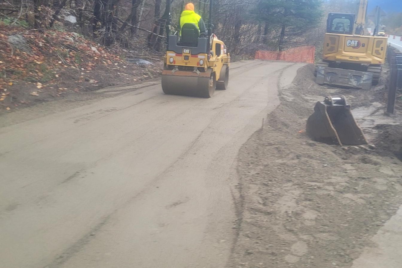
A worker on a roller compacting a pile of dirt along US 2 near Skykomish. An excavator sits along the berm next to the guardrail.
Crews began compacting soil that will make up an earth berm that will help protect US 2 from a
potential debris flow from the Bolt Creek Fire burn scar.

A berm made out of dirt along US 2 near Skykomish. An excavator is parked on the side of the road.
The completed earthen berm stands 6 feet tall and is 94 feet long. It will help protect US 2 in the event of a debris flow in the area, channeling the flow to a natural lower “catch” area.

Work crews placing a tan erosion blanket over the earth berm along US 2. A dump truck towing a trailer with construction equipment sits along the shoulder of the highway.
An erosion blanket is placed atop the new earthen berm. The berm will help direct a
potential debris flow in the area away from US 2.

The completed earthen berm with an erosion blanket over the top. An orange construction barrel sits on the shoulder of US 2 near the berm.
The completed earthen berm stands 6 feet tall and is 94 feet long. It will help protect US 2 in the event of a debris flow in the area, channeling the flow to a natural lower “catch” area.

Finishing up work

In order to get all of this work done, we had to make some changes to the traffic on US 2, but most of the work is done now. In spring 2024, we’ll add native plant seeds to help stabilize the area, but we won’t need any lane closures for that work.

Our maintenance crews will keep an eye on the highway along the burn scar, looking for downed trees and limbs, clearing ditches and culverts and looking for any early warning signs of a potential debris flow.

Hopefully, the berm and the fences are never tested by a debris flow, but Mother Nature is uncontrollable. What we can control is that we have taken the necessary steps to reduce the risk and keep US 2 open while the area recovers from the Bolt Creek Fire.

Monday, December 18, 2023

Answering your questions about toll rate changes for I-405 and SR 167

By Chris Foster

The Washington State Transportation Commission — which is responsible for setting toll rates — recently began work to assess and adjust toll rates for the Interstate 405 and State Route 167 express toll lanes. The Commission has released its toll rate proposal, which includes:

  • Increasing the minimum toll rate to $1
  • Increasing the maximum toll rate to $15
  • Extending evening tolling on I-405 by one hour, to 8 p.m.

The goal of the express toll lanes is to provide a reliable trip for transit, carpoolers and drivers who choose to pay a toll. To achieve this goal, the express toll lanes use dynamic pricing to set the toll rates.

When traffic volumes in the express toll lanes are low, the toll rate is low. As lane volumes increase, so does the toll rate which helps avoid overfilling the lanes to ensure a reliable trip for people choosing to use the lanes.

The Washington State Transportation Commission recently proposed
increasing toll rates on I-405 and SR 167.

The Commission has not adjusted toll rates for the SR 167 HOT lanes and the I-405 express toll lanes since the toll facilities opened in 2008 (SR 167) and 2015 (I-405). The decision to increase toll rates is never made lightly and is informed by careful analysis.

With that in mind, we want to provide a chance for you to share your thoughts on the proposed toll rate proposal.  You can get more information on the proposal, the process, the schedule and how to provide comments on the Commission’s website.  The Commission will hold its final hearing regarding the proposed changes at 9 a.m. on January 29. The hearing will be virtual and you can register to attend and comment on the Commission’s website.

We also know you probably have questions about the decision to adjust toll rates. We’ll answer some of the more common questions we receive and share the rationale behind why increasing the minimum and maximum toll rates is needed.

Why now?

With the new Renton to Bellevue express toll lanes scheduled to open in 2025, assessing the toll rates for the current facilities is necessary to ensure consistency for the future 50-mile corridor. However, a couple of different factors play into the updated timing for the rate adjustments currently being considered:

  • Per state law, the Commission is required to periodically review toll rates in relation to traffic performance of all lanes to determine if the toll rates are effectively maintaining travel time, speed and reliability. The Legislature included further direction regarding rate adjustments in the most recent transportation budget.
  • Population in the corridor has increased significantly since these facilities opened, and congestion has continued to worsen. As a result, the express toll lanes are unable to consistently meet their performance goals, and people paying to use the lanes are experiencing slower speeds.

One of the key metrics we use to measure express toll lane performance is how often traffic is traveling 45 mph or more during peak periods (5 to 9 a.m. and 3 to 7 p.m.). The graph below shows the percentage of time speeds reached or exceeded 45 mph during the past year.

Only the northbound I-405 peak period— which features more capacity with two express toll lanes between Bellevue and Bothell — is consistently meeting the 45 mph metric. The remaining three sections often reach the maximum rate due to high demand, at which point the ability to manage traffic and ensure a reliable trip is limited.

The Renton to Bellevue Widening and Express Toll Lanes project will add two new express toll lanes in each direction. Increasing the maximum rate will provide greater ability to manage traffic when many people are choosing to use the lanes, and help generate revenue for important corridor projects such as the I-405 Brickyard to SR 527 Improvement project and the SR 167 Toll Equipment Upgrade project.

Won’t this price out people who can’t afford to use the lanes for $15?

Most people won’t end up paying the maximum toll rate. In September 2023, the average daily toll paid by drivers with an active Good To Go! account and pass installed in their vehicle was $2.41 for the I-405 express toll lanes, and $3.36 for the SR 167 HOT lanes. During that same time, only 4 percent of trips reached the maximum rate in the I-405 express toll lanes, and 8 percent in the SR 167 HOT lanes.

If and when the toll rate reaches its maximum, that means many people are choosing to pay for a reliable trip, most likely due to heavy congestion in the general purpose lanes. We know some drivers will adjust their travel times, as the maximum toll rate is typically only reached during peak periods. Other drivers may adjust the way they commute (by joining a carpool or using public transportation).

How often will toll rates reach the new maximum?

We don’t know for sure how often the lanes will fill up and slow speeds down, causing the rates to increase. We do know that the current rates are reaching the maximum rate during peak periods more frequently, and when that happens, performance decreases as travel speeds in the lane slow down for everyone. In other words, people are paying for but not receiving the intended 45 mph or better speeds.

We looked at how often speeds were reaching 45 mph during peak periods in September 2023 from Tuesdays to Thursdays — which are generally the days we see the highest traffic volumes — and how often the toll rates were reaching their maximum during that same timeframe.

As you can see in the chart above, sections of the corridor that reach the maximum toll rate more frequently are meeting the 45 mph speed metric less often. In other words, once the toll rates reach their maximums, our ability to manage the lanes is limited and the result is slower speeds and a less reliable trip.

What is the timeline for these changes?

The Commission’s schedule for making changes to the toll rates is as follows:

  • January 17/18, 2024: The Commission will take public comment on the selected toll rate changes.
  • January 29, 2024:  The Commission will hold a final hearing to adopt toll rate changes, and public comment will be taken at the hearing.
  • March 1, 2024:  Toll rate adjustments take effect.

You can sign up to attend and provide comments at the two January Commission meetings on their website.